Cycling
Our cabin is surrounded by a vast network of picturesque back roads ideal for cycling — and we’re within riding distance of Skyline Drive. Here are some recommended rides.
Road rides
13.4 miles
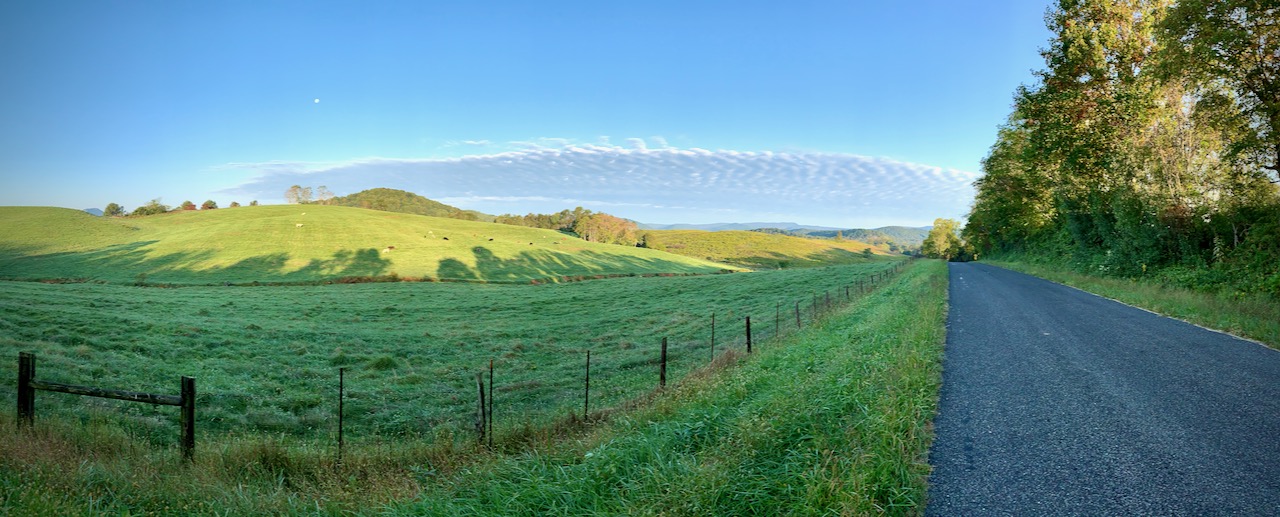
This short-but-sweet loop features spectacular views of central Shenandoah National Park and two wineries and one brewery.
28.7 miles
This ride explores the beautiful Robinson River valley through Syria and Criglersville. Essentially three out-and-backs, the route can be shortened easily, if desired. Start the ride in Syria to avoid the one major climb.
28.0 miles
This ride explores the beautiful Robinson River valley through Syria and Criglersville and the Hebron Valley down to the historic Hebron Lutheran Church.
29.9 miles
Low-traffic route through the Virginia countryside, passing by two wineries and one brewery.
35.6 miles
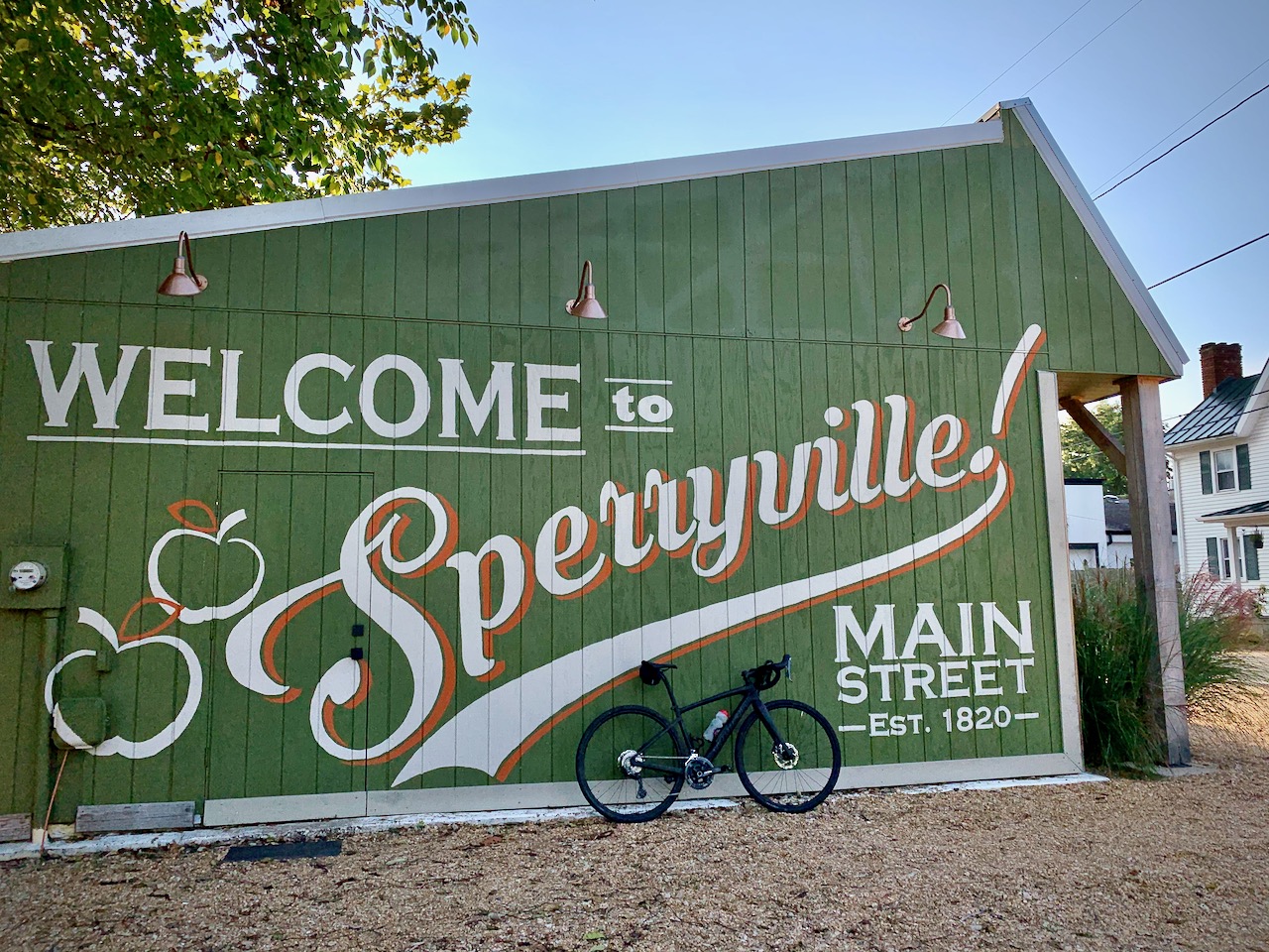
This loop, through the foothills of the Blue Ridge Mountains, features a stop in Sperryville, with numerous options for food or a drink about 10 miles from the end.
57.2 miles
This rolling loop connects several small towns in the Virginia foothills.
48.8 miles
This ride is the adapted Intermediate Loop from the Tour de Madison. Stop mid-ride for a snack in Madison and, if so inclined, hit up Revelation Vineyards mid-ride, or Blue Quartz Winery or Shotwell Run Brewing Company near the end.
65.0 miles
This is the route of the Tour de Madison metric century, but starting and finishing in Etlan. Along the ride you will pass several wineries, breweries, and other places to take a break if desired.
36.7 miles
After a warmup on F. T. Valley Road, this ride climbs 1,600 feet to Thornton Gap and Skyline Drive in Shenandoah National Park. Continue on Skyline Drive for spectacular ridge riding.
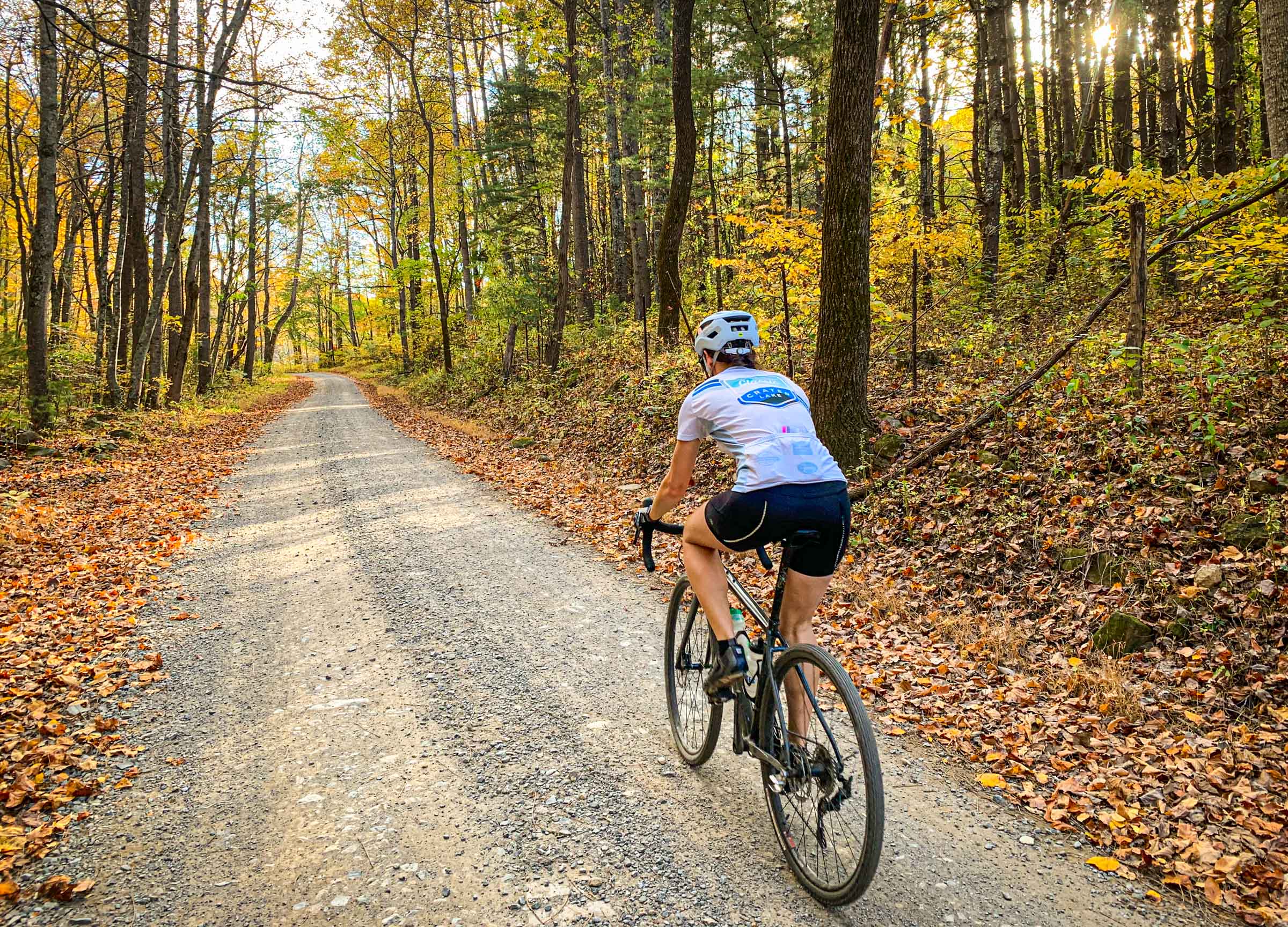
Gravel rides
See all the nearby gravel roads on gravelmap.com.
11.9 miles
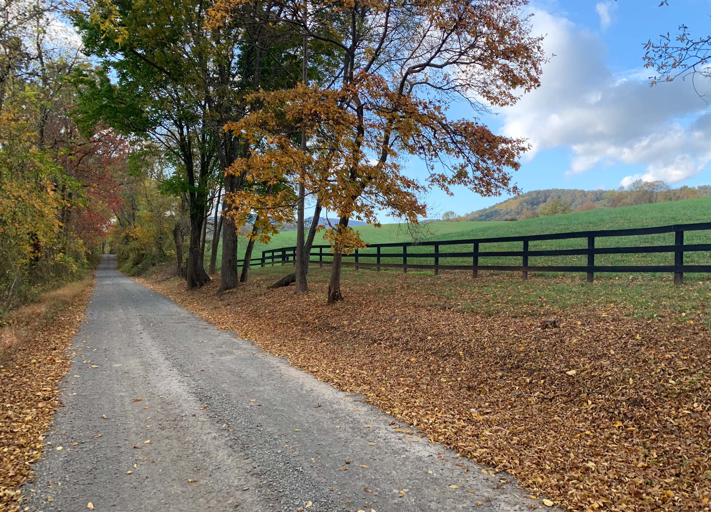
This easy gravel loop, in the shadow of Old Rag Mountain, explores the backroads around Etlan and Nethers.
Organized rides
If the timing works out, there are two excellent local organized rides.
In mid May is the Tour de Madison, starting and finishing at Graves Mountain Lodge down the road in Syria. Ride distances range from 20 to 65 miles.
The Rappahannock Rough Ride is in mid September and explores backroads of Rappahannock County from nearby Little Washington. Ride distances range from 20 to 60 miles.
Poorhouse Road/Etlan Road Loop
- Distance
- 13.4 miles
- Ascent / descent
- 700 feet
- Summary
- This short-but-sweet loop features spectacular views of central Shenandoah National Park and two wineries and one brewery.
You may ride this loop clockwise (as it is shown) or counter-clockwise. The clockwise direction ends with a decent hill but also has a general store near the end (mile 8.3) for sustenance.
Riding directions
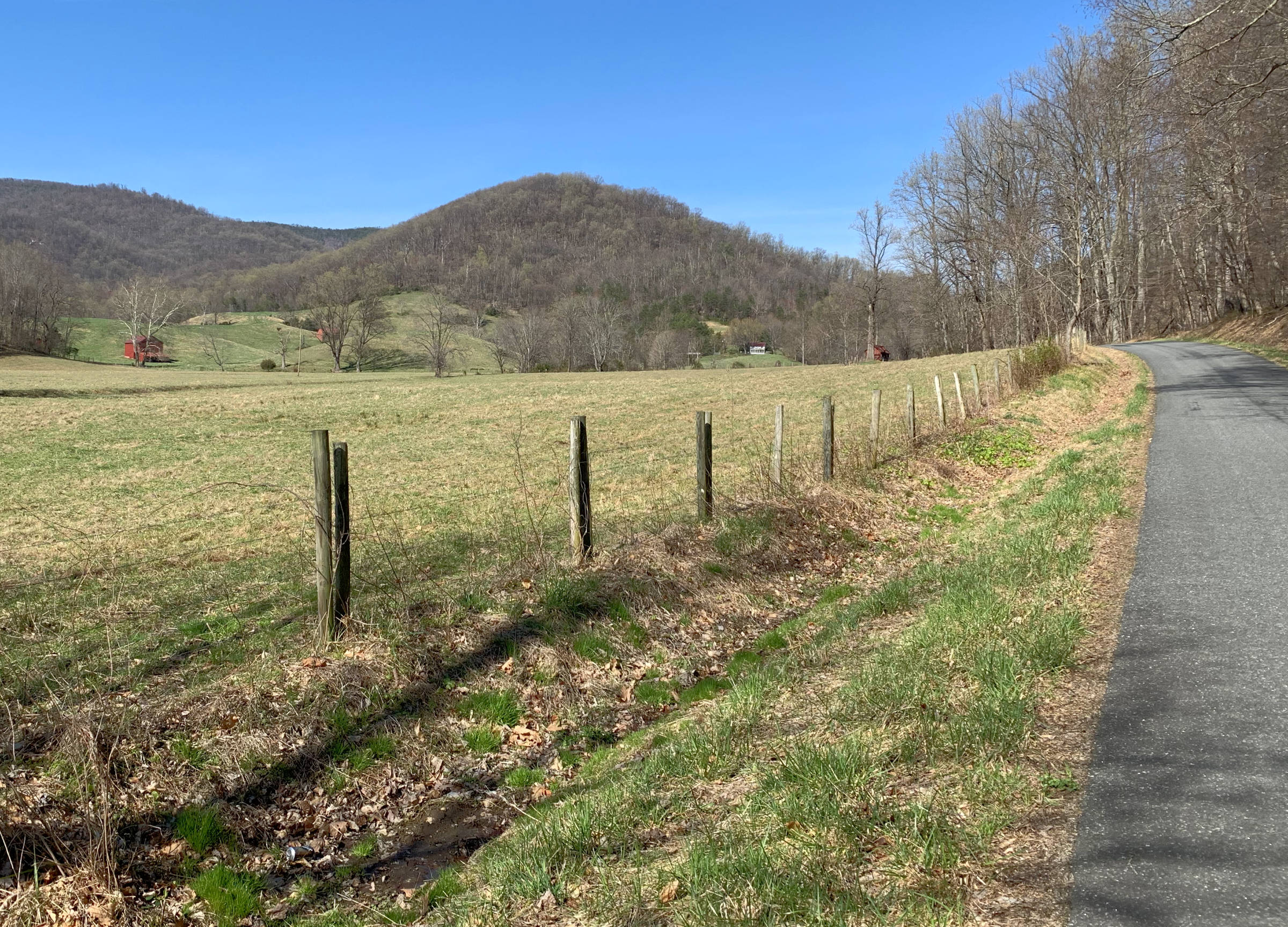
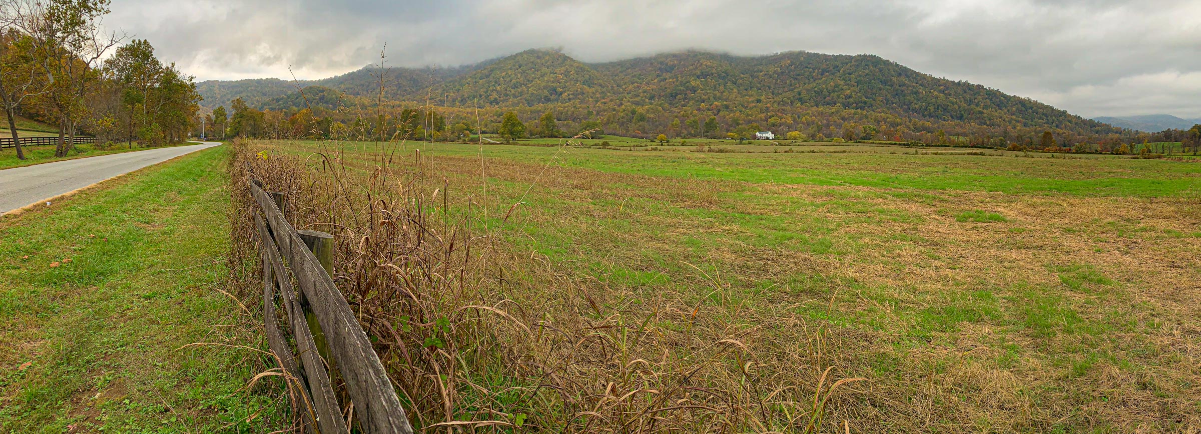
From Etlan, ride south on F. T. Valley Road (State Route 231) for 2.85 miles. Turn right on Poorhouse Road and roll through lovely farmland for 2.7 miles down to the old mountain town of Criglersville. Take a right onto the Old Blue Ridge Turnpike (State Route 670), which was built in the 1850s to connect the farms in the Shenandoah Valley with the railhead at Gordonsville. Enjoy the spectacular views of the mountains in central Shenandoah National Park.
In 2.7 miles reach the small village of Syria, with the Syria Mercantile general store available for a well-deserved cold drink and a snack and Graves Mountain Lodge up the road for those wishing to explore a bit more.
From Syria, go right on Weakley Hollow Road and in 0.8 miles take a right onto Etlan Road. The scenic Virginia countryside will make this climb more pleasant, as it progressively gets steeper and more curvy. The climb is a little more than a mile long, after which it is mostly downhill for the last 3 miles back to Etlan.
Kick back and enjoy a cold one
There are two wineries and one brewery on this short loop! If doing the loop clockwise, DuCard Vineyards off to the left on the back side of the last climb less than three miles from the end. If riding counter-clockwise, enjoy a well-earned drink at Blue Quartz Winery or Shotwell Run Brewing Company a little more than three miles from the end of the ride.
Syria Series of Out-and-Backs
- Distance
- 28.7 miles
- Ascent / descent
- 1,700 feet
- Summary
- This ride explores the beautiful Robinson River valley through Syria and Criglersville. Essentially three out-and-backs, the route can be shortened easily, if desired. Start the ride in Syria to avoid the one major climb.
This ride explores the beautiful Robinson River valley through Syria and Criglersville. Other than the climb and descent on Etlan Road at the beginning and end of the ride, the route is relatively flat with gentle grades. If you wish to avoid these steep climbs/descents, park your car at the Syria Mercantile and start from there. This option will take about 8.6 miles off of the total distance. No matter what you decide, the beauty of this ride is that, with the various out-and-backs, you can tailor your distance.
Riding directions
From Etlan, take Etlan Road 4.3 miles to Weakley Hollow Road and take a left and go 0.8 miles to Syria. Take a left onto the Old Blue Ridge Turnpike, a road built in the 1850s to connect the farms in the Shenandoah Valley with the railhead at Gordonsville. You will be riding through the gorgeous valley created by the Robinson River. After 3.6 miles arrive at the intersection with F. T. Valley Road (State Route 231), turn around, and head back toward Syria.
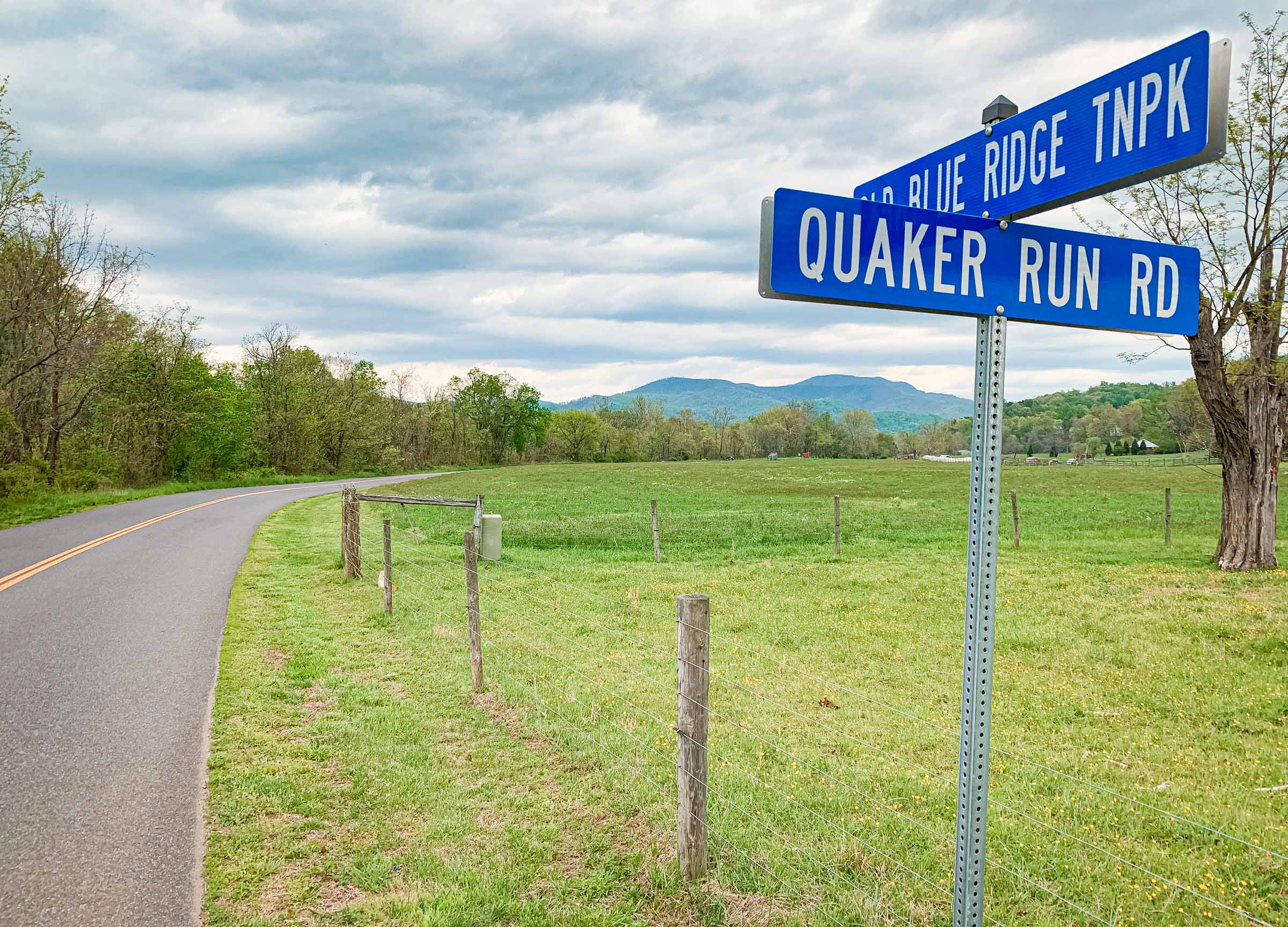
About 1.75 miles after the turn-around, past the village of Criglersville, turn left across the Robinson River onto Quaker Run Road. Enjoy the gentle climb through a charming mountain vale. This is the road that President Herbert Hoover had built for his presidential fishing retreat, “Camp Hoover,”” high up in the Blue Ridge Mountains at the headwaters of the Rapidan River. Be sure to turn around before the serious climbing starts (after a little less that 2 miles) and head back to the main road.
After another 0.5 miles on the Old Blue Ridge Turnpike, take a right turn onto Bohannon Road and enjoy the narrow winding route along the river, much of it near enough to hear the babbling brook. You might even have a chance to visit with a trout fisher along the way.
At the end of Bohannon Road, take a right on Weakley Hollow Road and follow the gentle climb past scenic cabins toward the headwaters of the Robinson River. In 4.1 miles turn around at the White Oak Canyon trail parking lot and follow Weakley Hollow Road 3.7 miles back to Etlan Road. Take a left and climb for 1 mile and then descend for 3.2 miles back to Etlan. If you are so inclined, drop in to DuCard Vineyards off to the left on the back side of the climb.
Hebron Valley
- Distance
- 28.0 miles
- Ascent / descent
- 1,350 feet
- Summary
- This ride explores the beautiful Robinson River valley through Syria and Criglersville and the Hebron Valley down to the historic Hebron Lutheran Church.
This ride explores the beautiful Robinson River valley through Syria and Criglersville and the Hebron Valley down to the historic Hebron Lutheran Church.
Other than the climb and descent on Etlan Road at the beginning of the ride, the route is relatively flat with gentle grades. A slightly shorter and flatter variation is to start from the Syria Mercantile. This option will make for a very flat 20.7-mile ride. See that route on Ride with GPS.
Riding directions
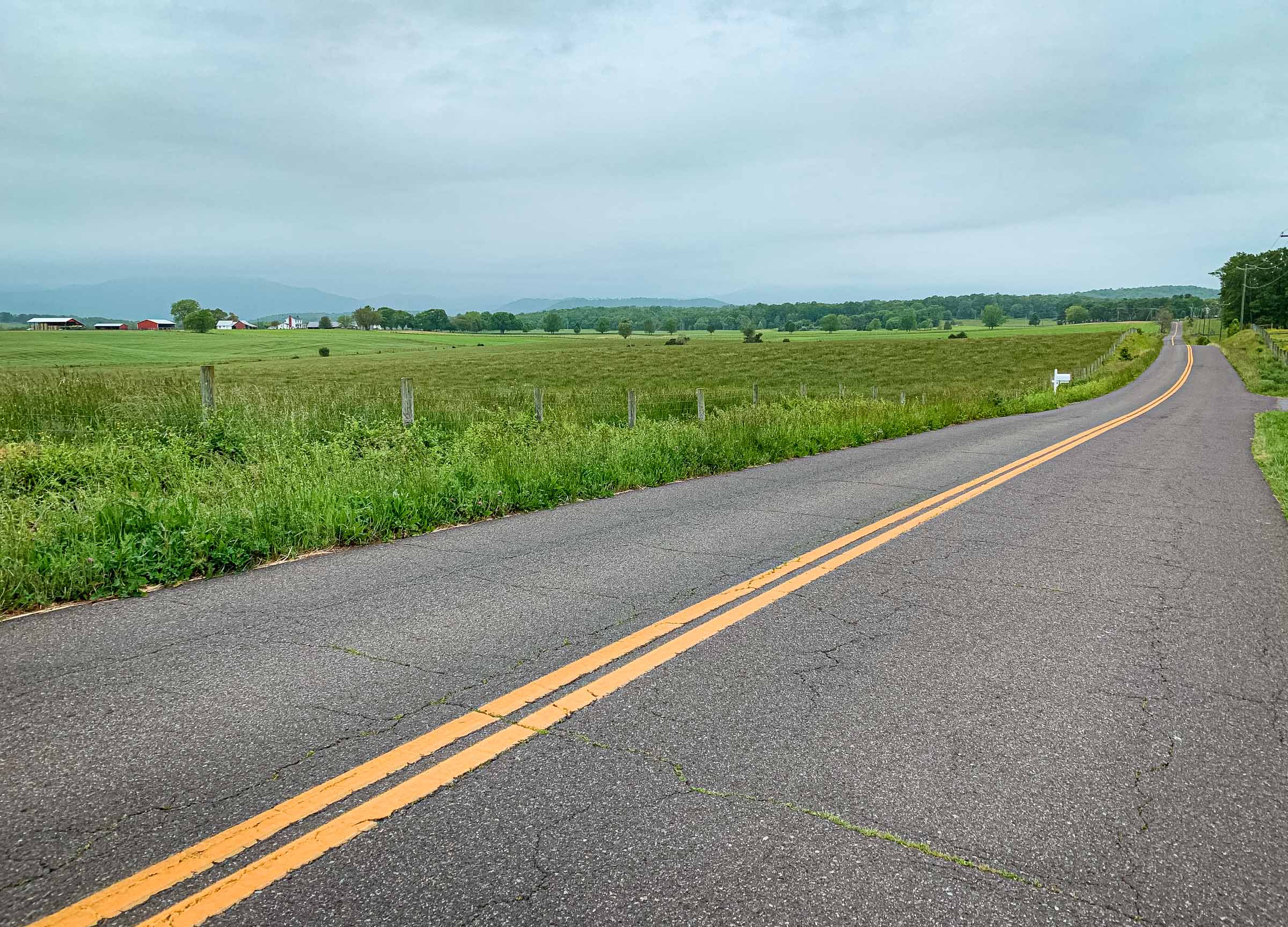
From Etlan, take Etlan Road (State Route 643) 4.3 miles to Weakley Hollow Road and take a left and go a couple hundred yards and take a left onto Bohannon Road. This quiet country road follows the Robinson River past fields and forests and is one of Madison County’s best trout streams. At Old Blue Ridge Turnpike (State Route 670) go left for 2.4 scenic miles then right onto F. T. Valley Road (State Route 231). After 0.5 miles, take a left on Hoover Road (State Route 609) along the river. After 1.8 miles, a gentle climb will bring you to Hebron Valley Road (State Route 603) on the right. After the first mile, the road opens up to reveal to some of the most spectacular scenery in Madison County. Take a right on Hebron Church Road (State Route 638) to the Hebron Lutheran Church. This is one of the most historic churches in the area and the setting for a debate in 1789 between James Madison and James Monroe over the new Constitution and fate of the new federal government, as well as a seat in the U.S. House of Representatives.
Turn around at the church and retrace the route back to Criglersville, at which point take a right onto Poor House Road (State Route 642). In 2.6 miles take a left on F. T. Valley Road (State Route 231) and, if you are so inclined, enjoy a well-earned drink at Blue Quartz Winery or Shotwell Run Brewing Company. From there, is a little more than three miles back to Etlan.
Etlan-Slate Mills-Novum-Haywood-Criglersville-Syria Loop
- Distance
- 29.9 miles
- Ascent / descent
- 2,400 feet
- Summary
- Low-traffic route through the Virginia countryside, passing by two wineries and one brewery.
Sperryville Loop
- Distance
- 35.6 miles
- Ascent / descent
- 2,700 feet
- Summary
- This loop, through the foothills of the Blue Ridge Mountains, features a stop in Sperryville, with numerous options for food or a drink about 10 miles from the end.
This loop, through the foothills of the Blue Ridge Mountains, features a stop in Sperryville about 10 miles from the end, with numerous options for food or a drink. We recommend eating at the Sperryville Corner Store or Rappahannock Pizza Kitchen, getting a cold one at Hopkins Ordinary or Penn Druid, or simply a coffee at Before & After.
If you’re looking for a shorter ride to/from Sperryville, the most direct route is a 21.2-mile straight out-and-back up F. T. Valley Road. See that route on Ride with GPS.
Etlan-Sperryville-Washington-Flint Hill Loop
- Distance
- 57.2 miles
- Ascent / descent
- 4,100 feet
- Summary
- This rolling loop connects several small towns in the Virginia foothills.
This rolling loop connects several small towns in the Virginia foothills — Sperryville, Washington, and Flint Hill — each of which have places to drop-in for a snack or coffee. Our favorites are Rappahannock Pizza Kitchen and the Sperryville Corner Store in Sperryville and Griffin Tavern in Flint Hill. Another noteworthy eating establishment — town of Washington is home of the World-renowned Inn at Little Washington (good luck getting seated there).
You can shorten this loop to 45.8 miles by bypassing the sidetrip to Flint Hill. See that route on Ride with GPS.
Etlan to Madison Half Century
- Distance
- 48.8 miles
- Ascent / descent
- 2,800 feet
- Summary
- This ride is the adapted Intermediate Loop from the Tour de Madison. Stop mid-ride for a snack in Madison and, if so inclined, hit up Revelation Vineyards mid-ride, or Blue Quartz Winery or Shotwell Run Brewing Company near the end.
This ride is the adapted Intermediate Loop from the Tour de Madison. Stop mid-ride for a snack in Madison and, if so inclined, hit up Revelation Vineyards mid-ride, or Blue Quartz Winery or Shotwell Run Brewing Company near the end.
Tour de Madison Metric Century from Etlan
- Distance
- 65.0 miles
- Ascent / descent
- 3,800 feet
- Summary
- This is the route of the Tour de Madison metric century, but starting and finishing in Etlan. Along the ride you will pass several wineries, breweries, and other places to take a break if desired.
This is the route of the Tour de Madison metric century, but starting and finishing in Etlan. Along the ride you will pass several wineries, breweries, and other places to take a break if desired.
Thornton Gap Out-and-Back
- Distance
- 36.7 miles
- Ascent / descent
- 2,700 feet
- Summary
- After a warmup on F. T. Valley Road, this ride climbs 1,600 feet to Thornton Gap and Skyline Drive in Shenandoah National Park. Continue on Skyline Drive for spectacular ridge riding.
This is the closest access point to Skyline Drive in Shenandoah National Park, with much of the route along the picturesque and rolling F. T. Valley Road (State Route 231). After leaving Sperryville on State Route 211, the climbing begins in earnest, to the tune of 1,600 feet in 6.8 miles.
If you get to the gap and you’re looking for more, head north or south on Skyline Drive for some spectacular road riding along the crest of the Blue Ridge. A recommended destination is Elkwallow Wayside, 8 miles north of Thornton Gap on Skyline Drive, making for a 53 mile round trip ride. Usually open from late March through November, Elkwallow has a convenience store for refueling. Otherwise, the Sperryville Corner Store, Rappahannock Pizza Kitchen, or Headmasters Pub can provide sustenance on the way back. You may also drop in for a beer at Hopkins Ordinary or Pen Druid.
If you want even more climbing, ride down the west side of the ridge into Luray before retracing your steps.
Gravel: Etlan to Nethers Loop
- Distance
- 11.9 miles
- GPX file
- Download
- Ascent / descent
- 640 feet
- Summary
- This easy gravel loop, in the shadow of Old Rag Mountain, explores the backroads around Etlan and Nethers.
This easy gravel loop, in the shadow of Old Rag Mountain, explores the backroads around Etlan and Nethers. For a slightly shorter option, consider a simple out-and-back to Nethers.
Gravel: Etlan to Sperryville Loop
- Distance
- 35.1 miles
- Ascent / descent
- 2,400 feet
- Summary
This ride consists of two loops on the paved and gravel back roads between Etlan and Sperryville. If you don’t want to go to Sperryville, there is is a slightly shorter 30 mile option.
Gravel: Etlan to Big Meadows Out-and-Back
- Distance
- 42.9 miles
- Ascent / descent
- 4,560 feet
- Summary
An out-and-back from Etlan to Big Meadows and back. Dubious legality, so ride at your own risk.
Last updated October 30, 2020